Anyway,
make and mend. You may have read the
“make” – blog VII and VIII. Mending was
more about taking a day off from driving and deciding what to do. Too many choices of places and interesting
activities on North Island. The rain helped
by dissuading me from venturing off site.
Oh, and being able to soak in the thermal pools at will was good. The hot water here is very different from
Rotorua. As explained by signage in the
pool area, the hot water is tapped through a well into the plumbing system of a
3-5 million year old layer of ignimbrite (think Pompeii) which is still heating
up the surrounding groundwater. It
didn’t smell either. The signs said it was rich in N2 and CO2 rather than H2S. It thus tended to coat me and my swim trunks
with tiny bubbles, and to make my skin feel silky.
I
even got to the point of learning that there is no good TV in New Zealand, despite
access to a pair of Maori channels. I
felt rested by the end of the day, mentally prepared for the descent into the
Auckland urbanscape, saying adios to MG, and getting packed up for my flight to
Australia. The sun arrived in time to
set:
Clear
skies overnight, finally saw Scorpio, the Southern Cross, and the span of the
Milky Way.
Wednesday, May 29 – Awake around dawn, to sunrise over the
Pacific. Ow, bright. Pack up MG, with regret. I am sad at this conclusion. I will miss my old Nissan war pony. He did right by me. But a final day together, heading back to
Auckland. A good start by walking on
Waihi Beach:
Further
delay by having a look at the Martha Mine pit in Waihi. This is a gold and silver mine; the pit is
currently inactive, but mining continues underground (and under Waihi). Small on the scale of the Hamersley Iron
Mines, but still a big hole:
This
area at the base of the Coromandel Peninsula is NZ’s gold country. There was a serious 19th century
rush in the mountains east of Waihi.
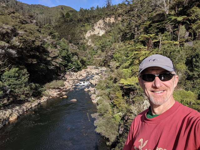
Much of the infrastructure from this is now subsumed by the bush. There used to be a full sized stamp mill in
the area behind me in this picture, in Karangaheke Gorge:
All
done now, converted to hiking and biking trails.
Across
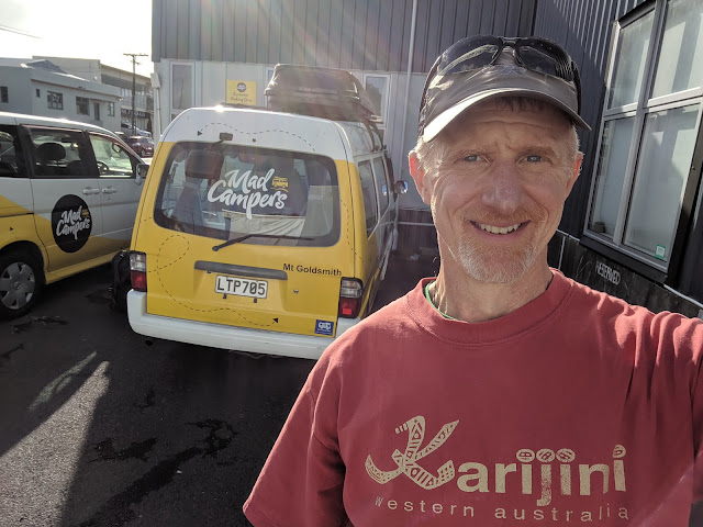
the Haurkai Plain (deltaic?) to Auckland on Route 2. Windy, MG aiming for spinnaker status. North on Route 1 (four lanes!). Back to Mad Campers. 1935 kilometers in MG. A chat with Amy and Hannah. Uber to my Airbnb.
Well,
it’s time. I’ve made it, all my stuff is
sorted. I have had a profoundly lucky
time on North Island. The weather was
unusually fine. Maybe chilly on race
morning and foggy on Tongariro, but overall, it was dry. People have asked me
how I find North Island, compared to South Island (which Paul and I toured in
2006). My answer; it’s more developed
(agriculture, tree farms, etc.) and more populous, for better or worse, and
there is a lot more to do. There is
basically a circuit one can drive around the montane core of South Island; here
you can zip around in more directions. I
think I saw everything that was at the top of my curiosity list. I learned I could have spent another week
walking on the beach (Northland will be on the next itinerary). It was also good for me to be here in the
off-season. I would have thrived less if
the places I went were crowded.
A
good phase one.
 |
| Goodbye to MG |
Thursday May 30 – Up at 3:15, in time for a 3:40 Uber to
Auckland Airport. My flight was at 6:20,
but all the Qantas check-in information urged a very early arrival. I tend to be twitchy about airline logistics,
so I was happy to comply. My luggage
weighed 2 kg less than at SFO. I can’t
figure out why; I’ve only added to the mass so far. I’ve certainly lost weight, which is equally
odd. I can’t be that much more active
than at home.
Adios
to my luggage. I trusted it would not
take a separate flight to Brisbane (it didn’t). Wonder the Auckland
international terminal, which has been fully renovated since my last pass
through. The expected Ikea-like winding
path through duty-free shopping. There must have been as much alcohol on offer
as in the average Costco. No need, nor
for sweets, perfume, electronics, or weird medicinal potions (green mussel
shell?). After a good kilometer walk, I
find my gate, where the e-signs say, Relax.
I do. These other signs made me
both amused and sad:
Finally
time to get tense and queued up. Here’s
my passport, here’s my boarding pass.
Jetway. Seat, tight like the last
Qantas 737. I am too groggy to care, and
the Chilean girl next to me will just have to enjoy my left knee in her
peripheral vision the whole way 3 hours and 55 minutes to Brisbane. Over the
Tasman, flying into morning.
Early
touchdown. Customs biosecurity inspector
is so happy I’ve washed my boots with detergent. Into Australia.
My
plan is to rent a car and drive 120 kms north out of Brisbane, to the Sunshine
Coast (this is a place) Hinterland (also a place), which is subtropical
rainforest, and do some hiking in Mapleton Falls National Park. Based on pre-trip research, it looked both
accessible and had promising walks.
So
Alamo Rental – just walk out that door, mate, it’s the only black Mitsu Mirage
in the first lot. It was, a little
econocar. My stuff fit. I fit.
It was new, at 8500 kms 1/18th the mileage of dear MG. GPS set, off from Brisbane
International.
Numerous
initial happy impressions. I was back in
a familiar botany – acacias as far as I could see off the motorway. I was on a real highway – 4 lanes - 6
lanes! No random curves or
roundabouts. Almost like driving in
North America. I could relax and watch
the landscape go by. I had also changed
geology and hence geography. The coastal
plain was much flatter, with low mountain ridges inland. A much older landscape– most of this terrain
has been eroding and getting flatter for longer than New Zealand has been
land. Tectonic quiescence vs. tectonic
vigor. Also a familiar scenario from my
times in Western Australia, although there the ocean is to the west.
Australian
drivers tend to be genteel, so where the speed limit was 100 kph, most everyone
is cruising at 95. Works for me. In a new, peppy car, this was just fun. A final way to be certain I was in Aus a road
sign reading:
Redcliffe – 24 km
Cairns – 1629 km
North
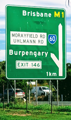
on the M1 Motorway, past Narangba, Burpengary (I did not make this up, see
below), Caboolture and Upper Caboolture.
I exited the M1 at Beerburrum onto Steve Irwin Drive (yes, that Steve
Irwin) to have a look at the Glass House Mountains.
Into
the Queensland countryside. The distinct
smell of rural temperate Australia – a mix of tea tree and eucalypt. Here overprinted by the odor of fresh cut
hay. I rolled all the windows down. I knew from my reading that the Glass Houses
were a look and see stop. Well worth it
for the again, typically Australian, flat plan with weird lumpy rocks sticking
up in the landscape:
These
11-13 peaks (geologists count differently than tourism boards) are the hard,
resistant cores of a bunch of Oligocene volcanoes that formed over the East
Australia Hotspot. At 25-27 million
years old, that’s an order of magnitude older than the Taupo Volcanic
Zone. The volcanoes are long gone, but
the volcanics persist, covered by the bush.
They were named the Glass House Mountains by Captain James Cook, who
poked around here in the 18th century. He thought they resembled English glass
foundries.
I
pressed on, taking backroads roughly northwest into the Blackall Range: more
eroded volcanic remnants from the from the East Australia Hotspot. I know, I shouldn’t drop all this geology in
here without explanation. A hotspot is a
relatively long lived plume of magma that forms deep in the Earth’s mantle,
through still debated processes that are largely independent of plate
tectonics, which does most of the shuffling of the Earth’s crust. Yellowstone, Hawaii, and Iceland are all
hotspots (there are lots more). Hotspots
often melt through the crust, hence volcanoes.
As a plate moves over a hotspot, you get a trail of volcanoes, like the
Hawaiian Island chain. The East
Australia Hotspot is still cooking, apparently; there are Aboriginal reports of
eruptions. I desist.
I
was driving through working lands like on North Island. More livestock here; Malney has a large
creamery (I got yoghurt). Fewer tree
farms. The ag land was more chopped up
by the ridges of the Blackall Range.
Along with thick strips of native bush along the roads, the landscape
felt more pastoral and less utilitarian and harsh. Lunch shopping and a long black in Beerwah. Malney, Montville, Flaxton, and finally
through Mapleton to the National Park.
A
tiny road sign, and as small car park. A
table and lunch. Moms and toddlers came
and went. A car full of local hoons
(based on the death metal music) cruised through. A French couple parked, got out and seemed to
argue. They were parked next to me in a
road trip-equipped car from West Australia.
If they’ve driven that far, they can be fussy.
Fed,
so to hike. “Great Walks” are a thing
here, basically hiking and or biking trails that are strung together to attract
tourists, and I suspect to encourage conservation. I followed part of the Sunshine CoastHinterland Great Walk.
Subtropical
rainforest looks a bit different than subalpine heather. Broadleaf understory, and the middle story
and canopy a mixture of acacias – turpentine, blackbutt, brush box, flooded gums. A familiar arrangement: far from Middle
Earth. Surprisingly dark once I got away
from the trailhead:
My
DSLR wanted to shoot at ISO 1600. Quiet
in the early afternoon other than my footfalls and occasional stumbles. I wandered vaguely uphill, crossing a few
streams with dense stands of piccabean palms, which like the damp:
The
big ones grow amazing buttressed trunks:
A
trail sign explained how to deal with leeches, which are common here when it’s rainy. I found a forest road and somehow lost the Great
Walk. This made for better picture
making:
An
eventual intersection, and a return to my car.
Probably about 10kms in total. I
was tired, it had been an early day. On
to my Airbnb in Mapleton for a long night’s unconsciousness.
Friday May 31 – My plan was to return my vehicle and
move on to my downtown Brisbane Airbnb by evening. Having seen the Blackall Range, I thought it
would be nice to go to the ocean. I
decided to head to Noosa National Park.
I’d heard of Noosa. Asics made a
running shoe called the Noosa Tri for a few years; there is a famous triathlon
there. The shoes were something west of
Jackson Pollock. They didn’t fit me
well.
Neither
did Noosa. To get to the park, I had to
navigate through kilometers of progressively more upscale beachfront communities. Another abrupt transition after the quiet of
the Blackalls. There was no parking at
the trailhead. Rather than circle, I
went to Plan B, going down the coast for a hike up Mt. Coolum, another blob of
volcanic rock right at the coast. It
promised good views. But this park was
closed: trail maintenance. Well, Plan
C. I’d seen a sign a bit up the road –
Beach Access. This turn led me thorough
dozens of beach houses to Point Arkwright.
Success. A long walk, an hour of
staring at waves, and lunch before getting back on the road. A few pictures:
 |
| I am glad it was too cold to go for a swim |
Airport. Skytrain to Brisbane CBD. Haul my luggage about a kilometer to my Airbnb
in Brisbane Skytower. Lovely augen gneiss
pavers on the sidewalks, but making for a rough surface. Another short term home, but with a view this
time:
Gympie
is somewhere northwest of Noosa. Every time
I used my navigation app, it seemed to say “take the (insert name of town)-Gympie
Road” etc. I was beginning to think I
was destined to go to there. I did not.


I'm enjoying your reports and photos immensely, Scott.
ReplyDelete